By Morgan William Graham, GIS & Wildlife Specialist
Do you love pouring over maps? Do you like reading the names of tiny lakes and creeks and imagining what seldom seen plants, rocks, and animals might be out there? Do you use a map and your imagination as motivation for launching a new adventure into the unknown? Have you ever wondered where all the water around us is coming from? Do you have an interest in collaborating with your community to improve water quality and management?
For the first time ever, you can look at a map of all the water in Teton County, Wyoming. Known as the Surface Water Inventory (SWI), the new map leverages all existing hydrographic data to accurately describe the name, location, and water rights associated with surface water in Teton County.
An overview of the SWI polygon (lakes, ponds, and reservoirs) network.
An overview of the SWI polyline (creeks, rivers, and ditches) network.
U.S. Geological Survey 1963 topographic map depicting water in Jackson, WY... we can do better!
Teton Conservation District prioritized the need for a detailed digital representation of water within Teton County to better inform surface water permitting, agricultural production, irrigation maintenance, water quality monitoring, flood prevention, land valuation, natural resource planning, stormwater mitigation, fisheries management, wetland and habitat assessments, recreation planning, and more. Prior to the release of the SWI, the names of some streams, ditches, and reservoirs and their associated water rights were a mystery. There was no singular avenue for efficiently identifying water right conveyances across Teton County. Knowledge of these features existed largely within the minds of private landowners, agency staff, and consultant project files. Up until now, there had been no justification or mandate to consolidate all naturally occurring and human maintained surface water into a single geospatial dataset. Users now have a shared tool to accurately describe all the natural and human-maintained surface water around them.
Deland Ditch scanned water right map c. 1900 acquired from SEO e-Permit Database.
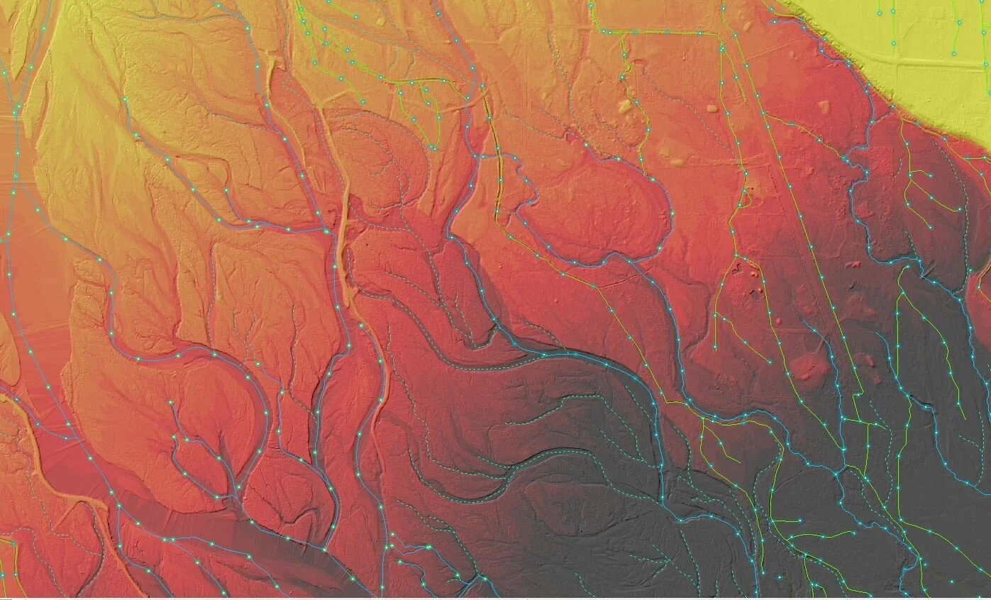
It took Teton Conservation District’s Wildlife & GIS Specialist, Morgan Graham and GIS Technician, Chauncey Smith four years of work to create the SWI. Their process was extensive: They reviewed and digitized 3,319 maps. They conducted an exhaustive inventory of all existing hydrographic spatial data. They maximized aerial lidar to literally peer into the unmapped understory. They identified and evaluated 30 existing water datasets originating from a federal, state, and local sources. They obtained all available water right information from the Wyoming State Engineer’s Office e-Permit database. They generated hundreds of thousands of lines and polygons from scratch to achieve their desired accuracy.
Although the SWI is the most comprehensive representation of Teton County’s water resources, it is referred to as SWI version 1, allowing for future iterations and updates. Version 1 focused on naming waterbodies and irrigation conveyances on approximately 70,000 acres of private land in the heart of Jackson Hole. Teton Conservation District staff will continue to work with landowners, agency personnel, and consultants to refine the existing information and add new features as new data become available. Additional areas that will be added or improved in SWI version 2 include private lands in the Gros Ventre River drainage, the National Elk Refuge, and Grand Teton National Park.
The SWI is available to the public in Geodatabase, Google Earth, hard-copy, and web-based formats. Click here to explore the SWI.
SWI watercourses displayed atop bare-earth Digital Elevation Model (DEM) and hillshade.


