By Elyce Gosselin, Natural Resources Technician for Teton Conservation District
Teton County is filled with charismatic landscapes. When you think of this area, the first scene that may come to mind might be the beautiful Teton or Gros Ventre mountain ranges, a thick stand of golden aspens you’ve hiked or biked through in the fall, or the amazing rivers and creeks that can be found all around us. Another important piece of the landscape that isn’t quite as charismatic is the rangeland—the grasslands and shrublands that domestic livestock and wildlife utilize as important foraging grounds and habitat. Rangelands are ubiquitous across the western U.S., and they are important for both wildlife conservation and livestock production. Unfortunately, rangelands are also facing natural and human-caused threats, including human development, fragmentation, invasion by introduced plant species, overgrazing, and changing fire regimes from altered plant communities and global climate change.
Teton Conservation District and Y2 Consultants are embarking on a two-year project to improve knowledge of the rangelands in Teton County. Specifically, we will monitor cattle and horse grazing allotments in partnership with the Bridger-Teton National Forest and livestock producers that utilize public lands. As a part of this project, we will establish new trend monitoring sites in both riparian and upland areas and collect vegetation and soils data at long-term monitoring sites, allowing for trends in plant community composition to be recorded. This information will allow land managers to evaluate whether the objectives in the allotment management plans are being met.
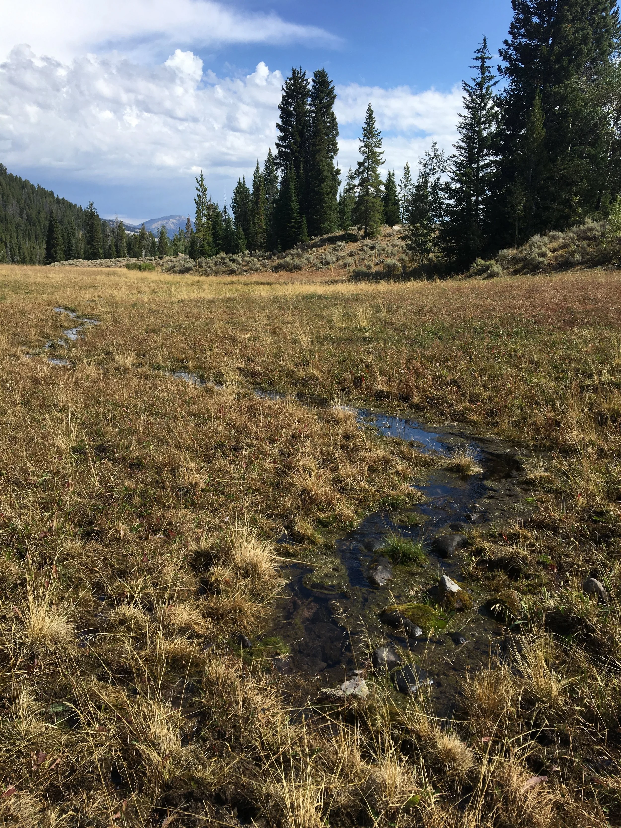
The spring that appeared at the West Miners Creek monitoring plot.
This fall, Robb Sgroi from Teton Conservation District and Dr. Chuck Butterfield from Y2 Consultants began data collection at a few of the allotments that will be monitored. The monitoring site at West Miners Creek in the Gros Ventre drainage was especially interesting this year because a new groundwater spring has emerged since the site was last visited about eight years ago. One of our collaborators from the Bridger-Teton National Forest, rangeland ecologist Martina Keil, suggested that the newly detected spring is the result of geologic activity. The spring has altered the vegetation community near the spring rather dramatically—unexpected changes like this make field studies challenging—but after some discussion, we decided to continue monitoring at the same plot.
Dr. Chuck Butterfield examining soil from different horizons within the sample hole.
There are two main components of data collection at range monitoring sites: vegetation community characterization and soil characterization. To characterize vegetation, we use rooted nested frequency plots, which are designed to provide estimates of the abundance of each plant species. Soils are characterized using soil pits. For this sampling, a two-foot hole is dug and each soil horizon is identified, marked, and measured. Then the clay content, color, and effervescence (an indicator of carbonate compounds in the soil, which is measured by adding hydrochloric acid to the soil and observing the bubbles that form!) of each horizon are characterized. Soil characterization is important because soil serves as a medium for the growth of plants. How soil develops is influenced by an area’s climate, topography, the activity of organisms, and parent material (such as the bedrock in the area). The soils of an area are part of the larger ecological context and can help us understand what plant growth can occur and what land uses are suitable for an area.
Stay tuned for more updates from rangeland monitoring next summer!


