
Drinking Water Quality Mapping Project
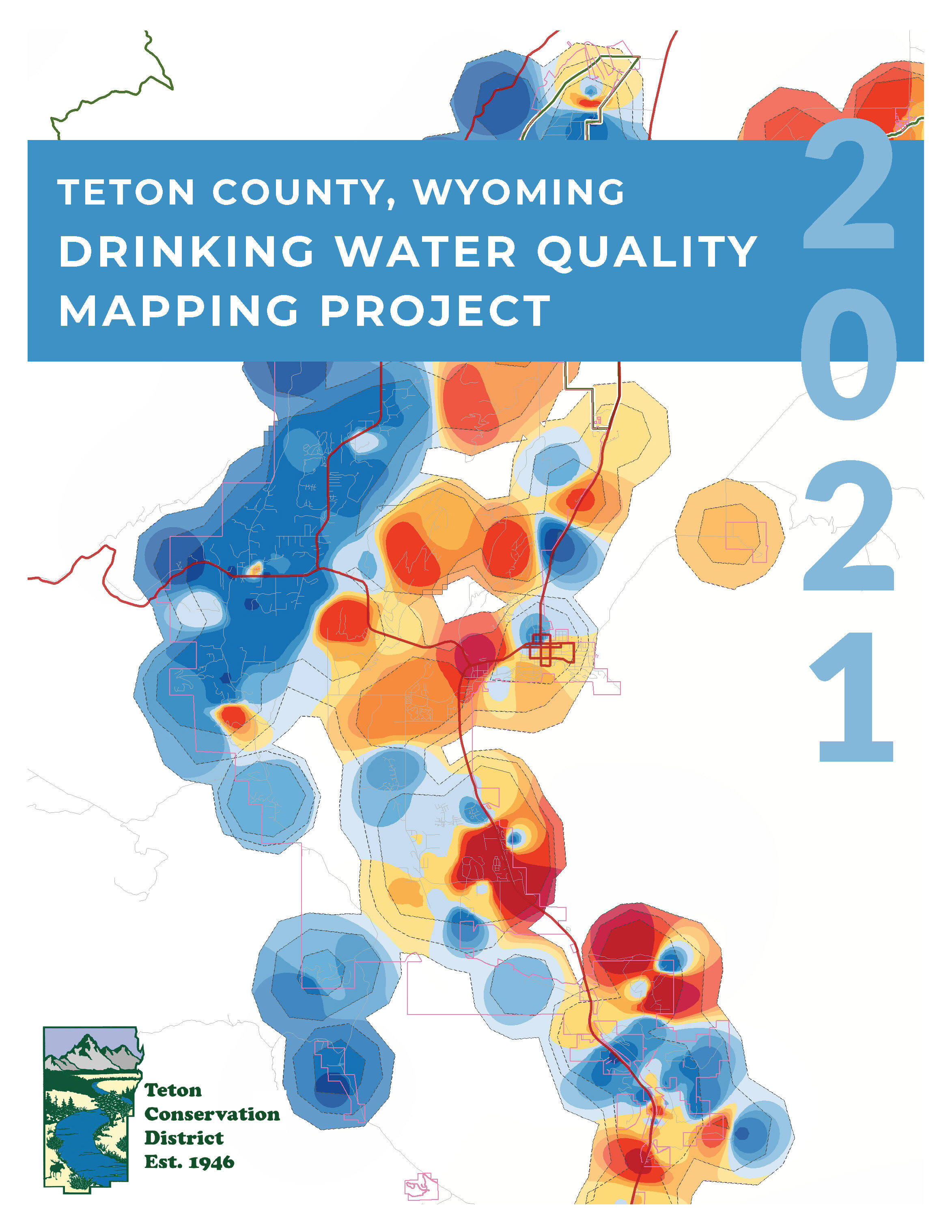
In January 2021, Teton Conservation District released the Drinking Water Quality Mapping Project. Teton Conservation District assembled data for eight water quality parameters from 360 groundwater locations, which included samples from both public water system and private drinking water wells. The parameters sampled were chloride, fluoride, nitrate, pH, sodium, sulfate, total dissolved solids, and total hardness. Through data analysis and modeling, maps were created for each parameter to illustrate the modeled groundwater chemical concentration throughout the study area.
Prior to this project, there were few accessible sources of information summarizing the significant body of drinking water well data that is available for this region. Teton Conservation District embarked on this project to offer property owners, health practitioners, resource managers, and the general public an accessible presentation of water quality data that will help characterize groundwater water quality and shed light on the scope and scale of potential issues. Teton Conservation District hopes that this tool is used to help identify areas where human health concerns are present, or could be developing. The nitrate map in particular could be incorporated into wastewater planning, drinking water protection planning, and development planning.
Click here to download the narrative portion of the Drinking Water Quality Mapping Project Report. The narrative provides an overview of the process, project outcomes, and intended uses, as well as the eight parameter maps. The parameter maps can also be individually downloaded below.
Maps
The eight maps below present the modeled groundwater concentration for each water quality parameter included in this project. Each map has the model, which illustrates the concentrations of the water quality parameter, as well as a layer illustrating the confidence in the modeled concentration. Confidence intervals were determined according to the amount of underlying data was collected in the area. Some sites had repeated sampling events, which were summarized so that one value per parameter was created for each site. Click the links below to download the map for each parameter.
Disclaimer
The Teton County, WY Drinking Water Quality Mapping Project maps and the associated narrative report are available for public use. Please cite Teton Conservation District (TCD) as the author. End user assumes all responsibility for interpretation or misinterpretation of these products. The accuracy or reliability of these maps and the narrative report is not guaranteed or warranted in any way and Teton Conservation District, expressly disclaims liability, whether expressed or implied, or of any kind whatsoever, including, without limitation, liability for quality, performance, merchantability and fitness for the particular purpose arising from the use of these maps and the associated narrative. Neither Teton Conservation District, nor its
employees, represent or endorse the accuracy or reliability of any information contained in the maps or the associated narrative. Teton Conservation District, and its employees reserve the right, at their sole discretion, without obligation, to modify, add or remove all or portions of the data, at any time, with or without notice. this includes the correction of errors or omissions within the underlying database. all data, maps, or information provided by Teton Conservation District shall be used and relied upon only at the user’s sole risk, and the user agrees to indemnify and hold harmless Teton Conservation District, officials, officers, and employees, from any liability arising out of the use or distribution of these data, and their resulting products.